Day 22: A Fortified Town, Panoramic Views, and a Church Island
- Katherine Kaczmarski
- May 29, 2022
- 4 min read

Updated: Sep 12, 2022
5/28/22

I had a delicious burek for breakfast- a meat pastry. This is Balkan "fast food." It's even tastier and more affordable than our quick places in the US!


First, we saw the fortified town of Kotor, a UNESCO World Heritage Site.
The first mention of the town is in Roman documents in 168 BC, but some scientists say it could be two millennia old, when the Illyrians settled this spot. It's been fortified since Roman times, with a wall snaking all the way up into the mountains, giving it the name "the Great Wall of Montenegro."
You can see the Italian influence in the architecture- Kotor was a Venetian colony and had/has close social and economic ties with Italy.
The seventh picture is a church that was simultaneously Orthodox and Catholic! To quote the tour guide, tolerance is a way of life here.
Being a port city, it also has a very rich naval history. The museum we visited had a rich collection of interesting items.
These miniatures include some of the ships that used this port, and some of the heavily ornamented weapons of the many nobles that lived there. Included in this is one of the first women's self defense weapon I've seen- the one that looks like claws! This would have had feathers and lace on it making it a lady's fan, but with sharp slicing blades hidden within. Times were dangerous, and especially as the wife of a seafarer, women would have to have a way to defend themselves when they lived alone during the extended periods of time husbands were at sea.


Also here are two bottles used to send messages. One says "For my true love," and seeing this is funny because sending messages this way apparently really happened. Another thing I learned was that the nautical measurement of speed, knots, actually is named that way because sailors used to measure their speed with a knotted rope device just like the one pictured in the bottom right. That name makes so much sense now!

This town was never conquered by the Ottomans though they tried- Kotor was able to protect itself since it is in a very strategic position at the back of the gulf. On one side of the city is water, and the other backs up to nearly impassable tall, steep mountains. In the chokepoint of the bay, they used to put chains across the opening to prevent pirates from entering since it is only about 100 meters across. This strait is even named Verige, which means chains.
Also on this map are Perast and Our Lady of the Rocks, which we visited next. :)


The mosaic lamps are a personal favorite. Though they're actually a Turkish import, I had fun looking at the many stores of them and decided I'll be getting one online so I don't have to worry about getting it back in my suitcase.

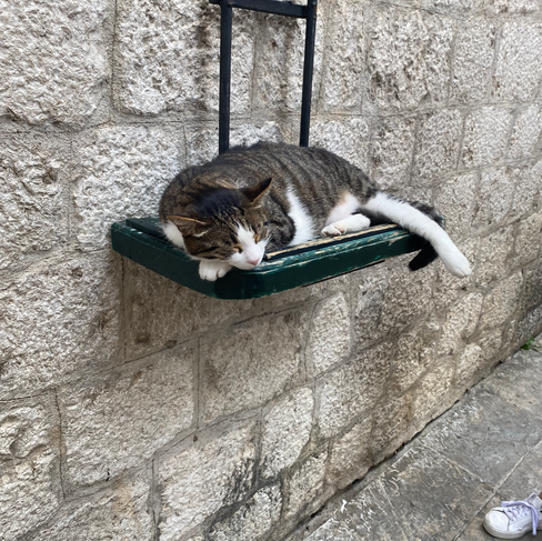


Good sweet street babies. <3
One found a shelf just for her, and the other blends in to the door step.
Next, arrived in Perast and then took a small boat to the Catholic church of Our Lady of the Rocks.

It is located on a picturesque man-made island in the bay. The legend goes they found a portrait of Mary and child on a crag in the water, and when they brought it back to land, it showed up there the next day. They took this as a sign to build a church in this very spot.


This is a church dedicated to sailors, and every time they believed Mary guided them to safety while at sea, they would bring a silver medallion of the ship (extremely valuable at the time) telling the story of the ship and the date. There are 2,500 of these that span 500 years of seafaring survival stories.

Also here is the oldest crucifix


We had a nice appetizer at lunch, and got to try real prosciutto which apparently is actually of Balkan origin that Italy capitalized on.
This, cheese, and bread was a tasty blend.
We took the scenic route- an incredibly mountainous road famous for its 26 serpentine hairpin switchbacks. Only in recent years did they add guard rails... oh my!
Somehow we made it up on this road in most places only big enough for one car, let alone a van and then double-decker buses (which I had no idea why they were allowed up there) and our driver being as excellent as he is maneuvered past huge tour buses.

We reached the top, and wow, what a view!

Here's a sweet panorama for you. We could see all the way down to the bay we just were in. Proud of this capture!

The man who built the road fancied the King's wife/the queen Milena so much that he built a section of the road in the shape of an M.
Simping of historical proportions. 🤣

Then, we arrived in Cetinje.


Finally, we saw the museum of Montenegrin King Nichola. He was the last king of Montenegro and a favorite of the people.
On the right you can see Queen Milena, which one can understand how her beauty inspired her wannabe lover to make the road shaped like an M for her.
The palace is a modest one, smaller and less opulent than Versailles, for example, but not solely because Montenegro is a smaller country, but because the King was close to his people. I also got the impression walking through the palace that it was a family home. Milena and Nichola had 12 children, one who became Queen of Italy and some of their other daughters were successful diplomats.
I knew nothing about the Montenegrin royal family going into this trip, but now I have a some interesting recent history I appreciate.

Also in Cetinje was a peaceful demonstration against neutrality on Ukraine. Montenegrin identity politics and internal divisions complicate the nation's official stance on Ukraine.
I really liked this quote by Virginia Woolfe, true words especially on this trip when we might not eat lunch until late and the hanger kicks in. 😅

Ćao for now!


Comments